In April of 2014, Cindy and I drove up California's central coast on a weekend getaway. The destination? The famous drive through Big Sur where coastal cliffs, coves, waterfalls, and redwoods combine for dramatic views. But as I shared in the first half of this blog post, the last-minute discovery of the Big Sur International Marathon thwarted these plans and sent us inland. We resigned from our endeavor and filed Big Sur in the "someday, maybe" category of places to travel to.
This year, Cindy and I set off on a new weekend getaway to Lake Tahoe, on the other side of California. In what is becoming an unfortunate trend for our weekend getaways, our plans fell apart due to poor accommodations and we had to cut our time in Tahoe short. We threw out our plans and chose to craft a new route home, starting in Sacramento where we could find a cheap, clean hotel. After weighing every possible option (we literally considered everything from Oregon to Los Angeles), we realized that this was the perfect opportunity to finish our drive down the central coast.
On this trip, we drove south along the red-route, making up the span we missed the previous year.
As with our first coastal trip, we planned to take two days to cross the state. For all of the ground we had to cover, we strived the rare goal of relaxation (or at least attempted so); on the first day, we would take it easy and visit a couple of San Jose-area destinations. The first one of these, directly in San Jose, was the Winchester Mystery House.
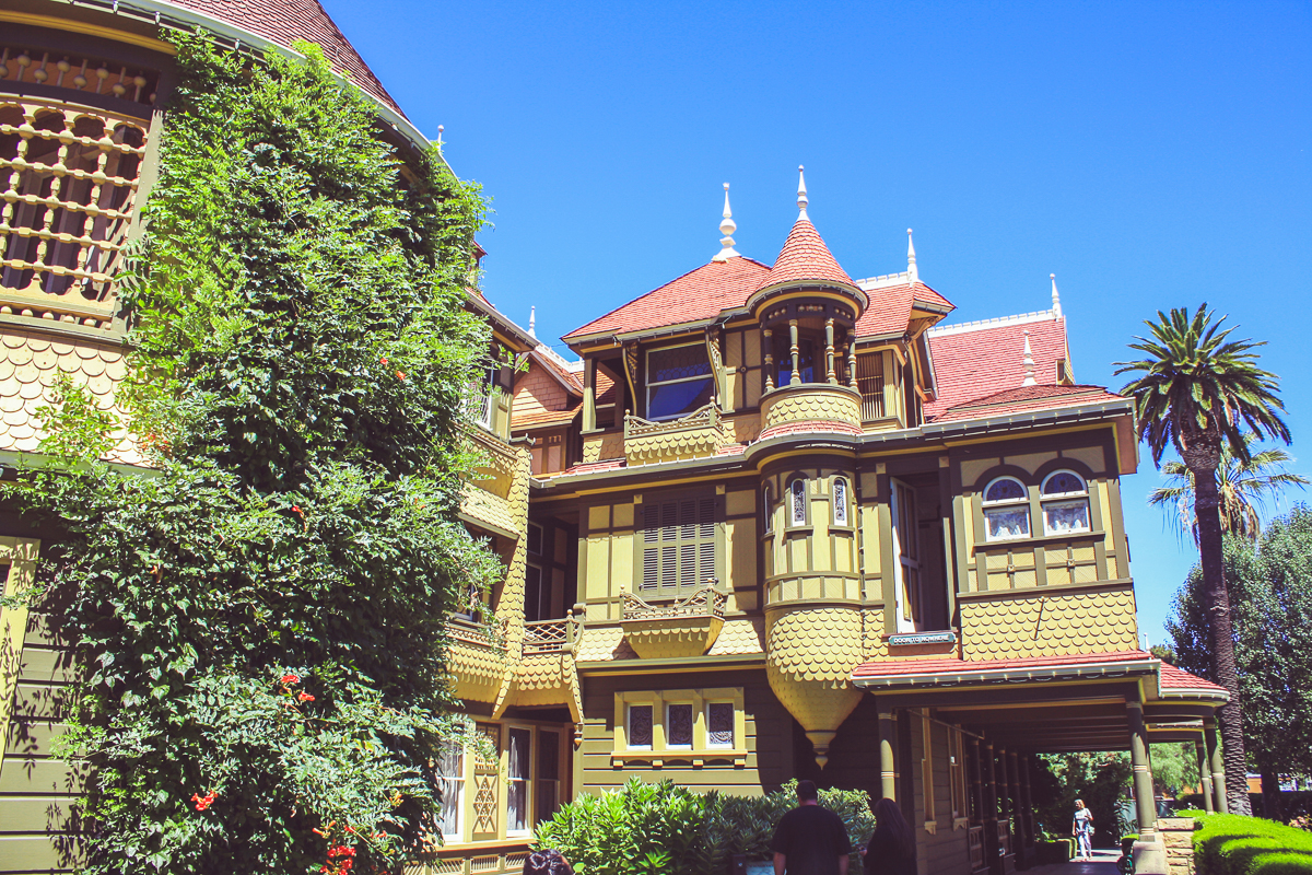
For those unfamiliar, the Winchester Mystery House is the name of the house purchased and built by Sarah Winchester, the wife of gun manufacturer William Winchester. In 1881, she inherited millions of dollars when her husband died, as well as a substantial ongoing income from his 50% stake in the Winchester Repeating Arms Company. With her ever-flowing fortune, she moved to San Jose, bought a small farmhouse, and then employed a staff of builders and carpenters to expand, modify, rebuild, and grow the little six-room house into a 160-room mansion.
The reasons why she built a house in such a unorthodox way rests less in hard facts than in legend. Some view her behavior as a strange hobby whereas others view it as a sign of insanity. The prevailing legend is that Mrs. Winchester believed she was haunted by the ghosts of all those killed by the Winchester Rifle. It is believed that she built non-stop in order to appease or confuse those spirits which haunted her. What is clear is that unplanned, non-stop construction has resulted in a building full of quirky anomalies, such as stairs that lead to nowhere, windows set in interior walls, and most famously, a second-story door that opens to a drop down.
Like the true story behind Mrs. Winchester's architectural choices, the Winchester Mystery House has many interpretations of its own. For some, it would be easy to dismiss the building as a shameless tourist-trap. Certainly paying $36, taking a picture in front of a green-screen, and entering and exiting through the gift-shop leads to that impression. Others may view it as a unique, well maintained, and monstrous example of Victorian architecture. And then, others yet may view it as the quirky, spooky, and fascinating physical manifestation of a haunted woman.
And like the story of Mrs. Winchester, all of these interpretations may be a part of the same truth. No matter the case, Cindy and I left the Winchester Mystery House ponderous, but growing hungry. To satisfy that hunger, it was time to cross off another "silly CA bucket list item".
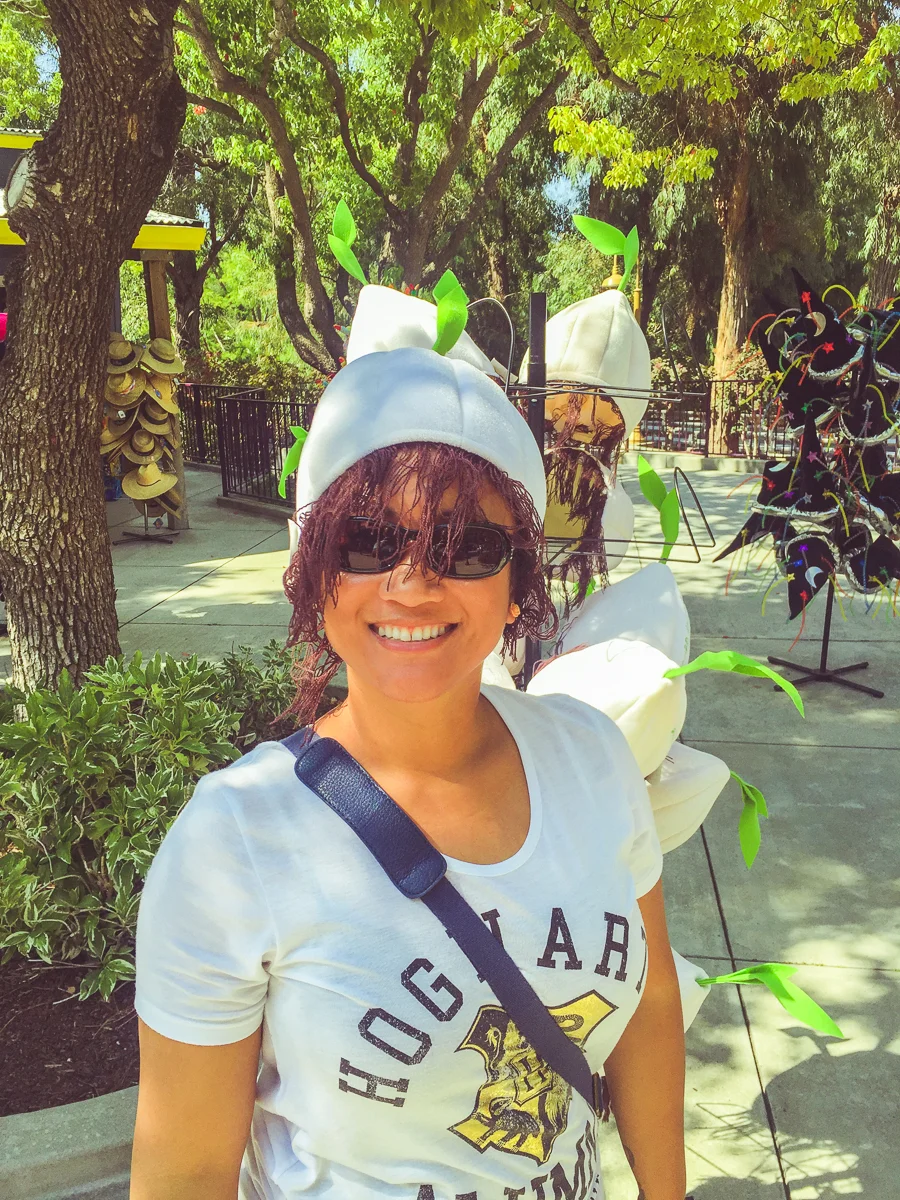
Just south of San Jose is the town of Gilroy, the self-proclaimed "Garlic Capital of the World". In Gilroy is a small amusement park/botanical garden known as Gilroy Gardens. And in Gilroy Gardens, Cindy and I were able to order some fried fish, artichoke hearts, and garlic fries, all served with a pale ale.
After lunch, we rode a few of the park's rides and checked out the gardens, known for trees with unusual shapes. Just like the Winchester Mystery House, Cindy and I were really glad to have visited. We crossed Gilroy Gardens off our list and don't really need to go back to either place.
Despite just two stops for the day, after Gilroy Gardens, we checked-in to our hotel, hit the pool, and called it an early night in preparation for the 380-mile drive ahead of us.
The next day, we were up and on the road early. Driving through Monterey, I took note that we were officially passing the furthest reaches of our previous trip. This fact would have been more celebrated if not for the morning rush-hour traffic we were caught in. Still, as we continued onto the lonely, 2-lane portion of Highway 1, the burden of driving lifted; the traffic peeled away and the open road before us became inviting.
Not 30 minutes later and we were already pulling over for our first stop, Garrapata State Park.
Garrapata features a couple of miles of shoreline and its neighboring coastal peaks. On the day we visited it was mild and peaceful out and we immediately fell in love with the place.
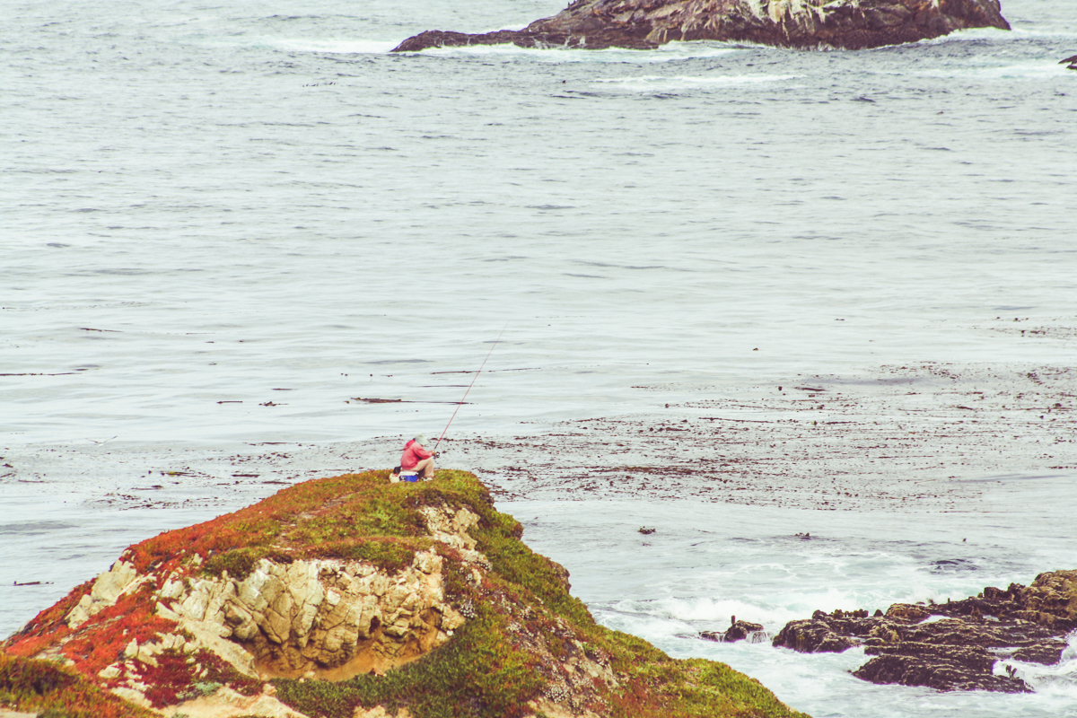
What was striking from the start to me was the rugged coves and crevasses tangled along the coast. Chipped out of the sandy rock by generations of crashing waves, these pockets were filled with teal water and wildlife. We saw a few birds and heard the barks of sea lions echoing through the shallow cliffs (unfortunately, we couldn't get close enough to see them). In the distance, a lone fisherman was perched on his tackle box in the multicolored, coastal vegetation.
We hiked for only 15 minutes or so along the coastal Soberanes Point Trails, snapping away and getting a feel for the place, but it was soon time to move on. The park's mountains featured coastal redwoods but we knew there would be opportunity for more forested canyons later.
We continued down the 1 and drove along Carl Sagan's original Shores of the Cosmic Ocean. Up ahead, one of the most famous bridges you know, but didn't know you know.
The Bixby Bridge is an iconic arch-bridge along the coast, over the Bixby Creek. You perhaps recognize it from car commercials or cringe-worthy "Visit California" advertisements (0:23). It is the most prominent in a series of Great Depression-era bridges on Highway 1, a romantic reminder of the public works projects and money necessary to complete this amazing drive.
Thanks to the early start, we had the bridge mostly to ourselves. Ever the hipsters, once others began to arrive, it was time to move on.
Just further down the road, we had risen to a perch 560 feet above the Pacific and stopped for more photos. Just beyond this turnout, we were driving and ran up against a caravan of 25 identical white vans. Clearly together as a part of some international touring company, the vans were driving under the speed limit on a section of road with few opportunities for passing. This is the kind of stuff that makes me rage-out pretty hard! The next 10 minutes were miserable for my impatient self.
Luckily, they pulled over to reorganize their arrangement and I took my chance to zip around them. This was at the entrance of the town of Big Sur, the namesake for which this entire stretch of coast is known for. Driving through the town, we saw soaring coastal redwoods above miniature gas stations and quaint bed-and-breakfastes. I'm sure when we're older, our "Big Sur Weekend Getaway" will look a lot more like stopping in this town, holing up at one of these joints, and getting our wine-on. But for now, we were happy moving on to our next state park.
Julia Pfeiffer Burns State Park is another coastal park with beaches, coves, and a canyon covered by forest. Its most prominent feature is McWay falls, an 80-foot waterfall that empties into the Pacific. We opted to save $10 and park "more dangerously" on the side of Highway 1 (anything to save a buck!).
After photos of ourselves with McWay Falls, the gorgeous cove it empties into, and some of the local wildlife, we were back onto the road. A mile or two further south, we passed the Esalen Institute, a famous teaching forum for the humanities and sciences, with focuses on "personal growth, meditation, massage, Gestalt Practice, yoga, psychology, ecology, spirituality, and organic food". Many renowned artists and scientists have lectured or learned there, from teachers like Ansel Adams, Ray Bradbury, B.F. Skinner, Abraham Maslow, and Alan Watts, to performers like Bob Dylan, Bruce Springsteen, Crosby, Stills, Nash and Young, George Harrison, and Ringo Starr. Of course, I knew of it from one of the final scenes in Mad Men (CAUTION: Possible Mad Men spoilers), which appears to take place in an Esalen-like environment.
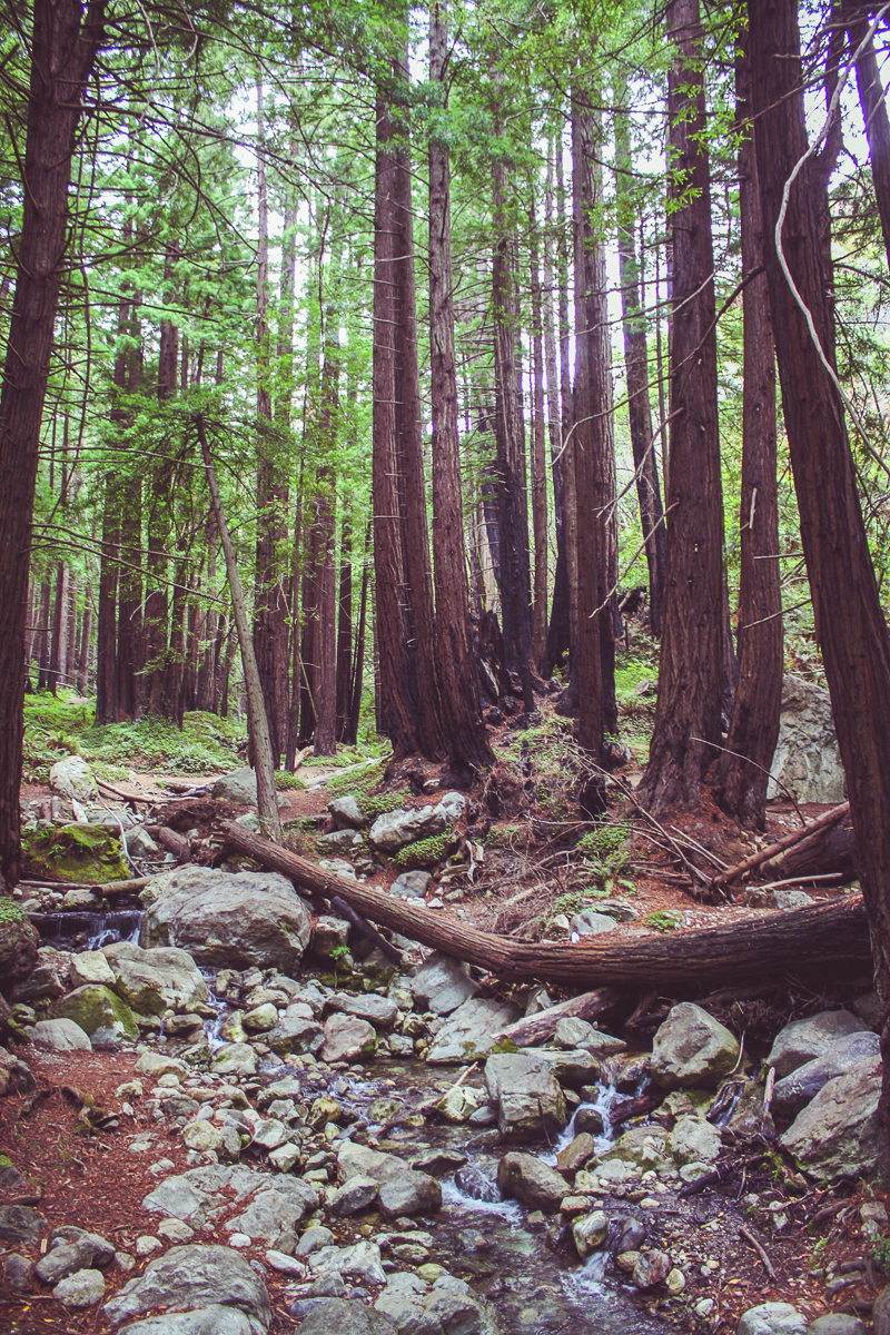
The next five miles beyond Esalen were some more the more treacherous of the drive. Perched high above the Pacific and zig-zagging between canyons and cliffs, there was less scenery and more white-knuckled turns. A drive like this leaves Cindy quietly contemplating how much she hates my driving. But soon, we were at our final stop, Limekiln State Park. Once crossing a bridge, we drove down into a canyon and parked. We were finally ready to see some redwoods!
In addition to its redwood forest, Limekiln State Park is home to a few unique landmarks. The first is the Limekiln Falls, ribbons of water that fan out along a cliffside when rainwater reaches the canyon. On this visit during California's dreadful drought, the falls were just a two small trails of water.
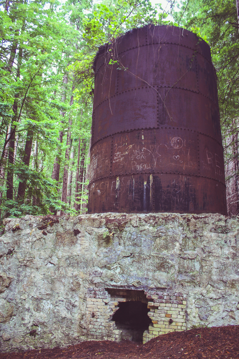
The other landmark is the limekilns the park is named after. Lime, a major ingredient in the concrete used to build San Fransisco and Monterey, could be burned out of the local limestone in these giant furnaces (with their fires fueled by the redwoods). Thankfully, the limekilns were only used from 1887 to 1890 and the region has since recovered. The forest has taken over the rusted furnaces in a scene that looks straight out of the Hunger Games.
After seeing the limekilns and the waterfalls, we were now 6 hours into our day and starting to feel hungry again. There was still 72 miles of winding road between us an our lunch at the Firestone Walker Brewing Company in Paso Robles (a drive that would take nearly 2 hours) so we knew it was time to leave. On the way down, there is a moment when the road straightens as it approaches San Simeon. I think Cindy and I both breathed a sigh of relief in knowing that the winding road was behind us.
We passed Hearst Castle, officially linking our drive from Monterey to the furthest southern point we reached the previous year. When we made it to Cambria, we turned left onto Highway 46 and cut across the rolling coastal mountains. In the distance, we could see Morro Bay (last year's half-way point), with Morro Rock defiantly resting in the bay's center. It was a beautiful day.
That is how we, on two separate trips across two years, finished driving the central Californian coast. A special nod goes to the real MVP of the trip, my Honda Fit. Though hardly sporty, it performed perfectly as it winded in-and-out of the cliffs and canyons of Highway 1. For more photos from this second half of our trip, check out the photo gallery below!


